
Drone Photography for Blue Mountains Listings
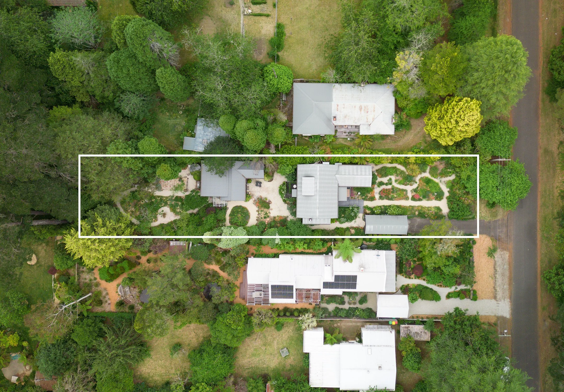
Aerial imagery gives buyers what ground-level photos can't — a clear sense of a property's boundaries, its position relative to the street, and what's within reach in the surrounding area. We provide professional drone photography for residential, commercial, and vacant land listings across the Blue Mountains, helping agents and developers market properties with imagery that answers a buyer's first questions before they've even booked an inspection.
Every drone shoot is tailored to what the listing needs to communicate — whether that's a clear overhead view of a house and its block, a labelled map of nearby schools, shops, and transport for a family buyer, or a full aerial survey of a vacant block being marketed for its development potential.
As a CASA-certified drone operator local to the Blue Mountains, we are familiar with the laws and regulations that will ensure that aerial imagery is captured safely and legally.
Drone Photography Services
Residential drone photography Overhead and angled aerial shots showing the full property, its position on the block, and its relationship to the street and neighbouring properties. Ideal for larger blocks, acreage properties, and homes where the land itself is part of the sale.
Commercial drone photography Aerial imagery for commercial properties, showing site layout, parking, access points, and surrounding infrastructure — useful for leasing, sale, and development marketing material.
Property boundary overlays Aerial shots with the property's boundary lines clearly marked, giving buyers an accurate, at-a-glance understanding of exactly what land is included in the sale — particularly valuable for larger or irregularly shaped blocks.
Labelled local amenity shots Aerial imagery showing the property in the context of its surroundings, with nearby amenities — schools, shops, cafes, parks, train stations — clearly labelled on the image. This helps buyers unfamiliar with the area quickly understand a property's lifestyle and convenience factors, directly from the listing photos.
Vacant land and development blocks Aerial photography for vacant and unimproved blocks being marketed for sale or development, showing the block's shape, size, topography, access, and surrounding context — key information for developers and buyers assessing a block's potential.
Why aerial imagery helps a listing perform for clients
Aerial photography answers questions buyers would otherwise have to ask an agent directly: How big is the block, and where exactly do the boundaries sit? What's within walking distance? What does the land look like on a vacant block with no structures to give it scale? Listings that answer these visually tend to generate more qualified enquiries, since buyers who click through to book an inspection already understand the fundamentals of the property.
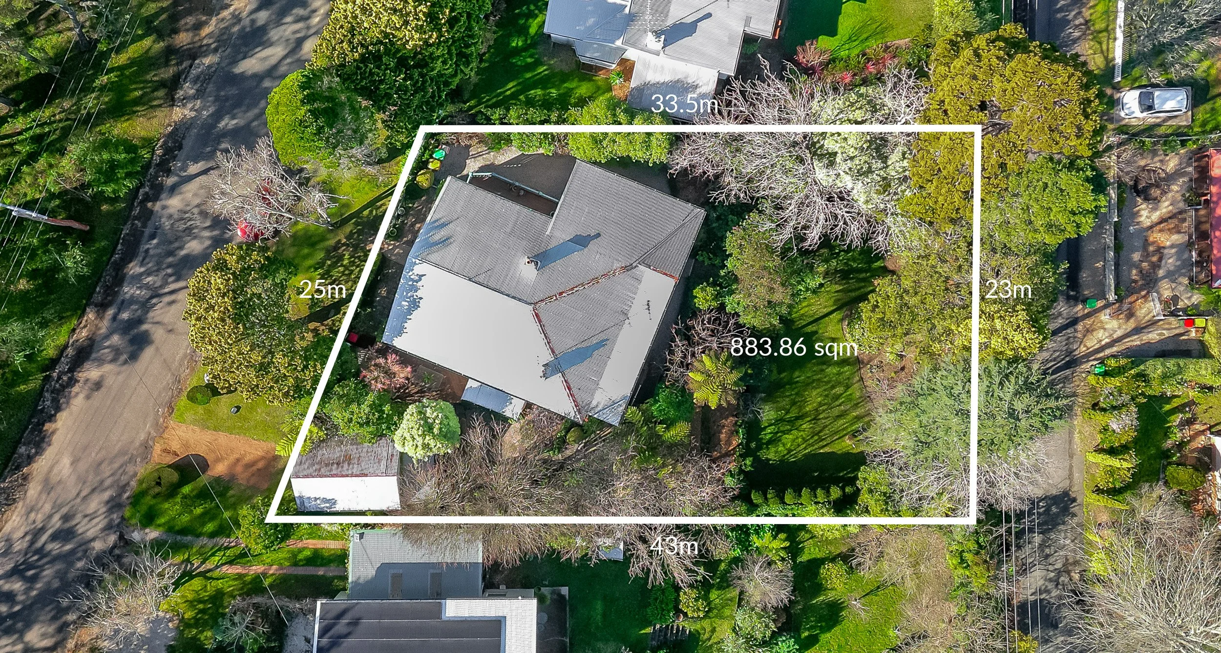
Overhead drone shot with boundary lines and approximate sizes
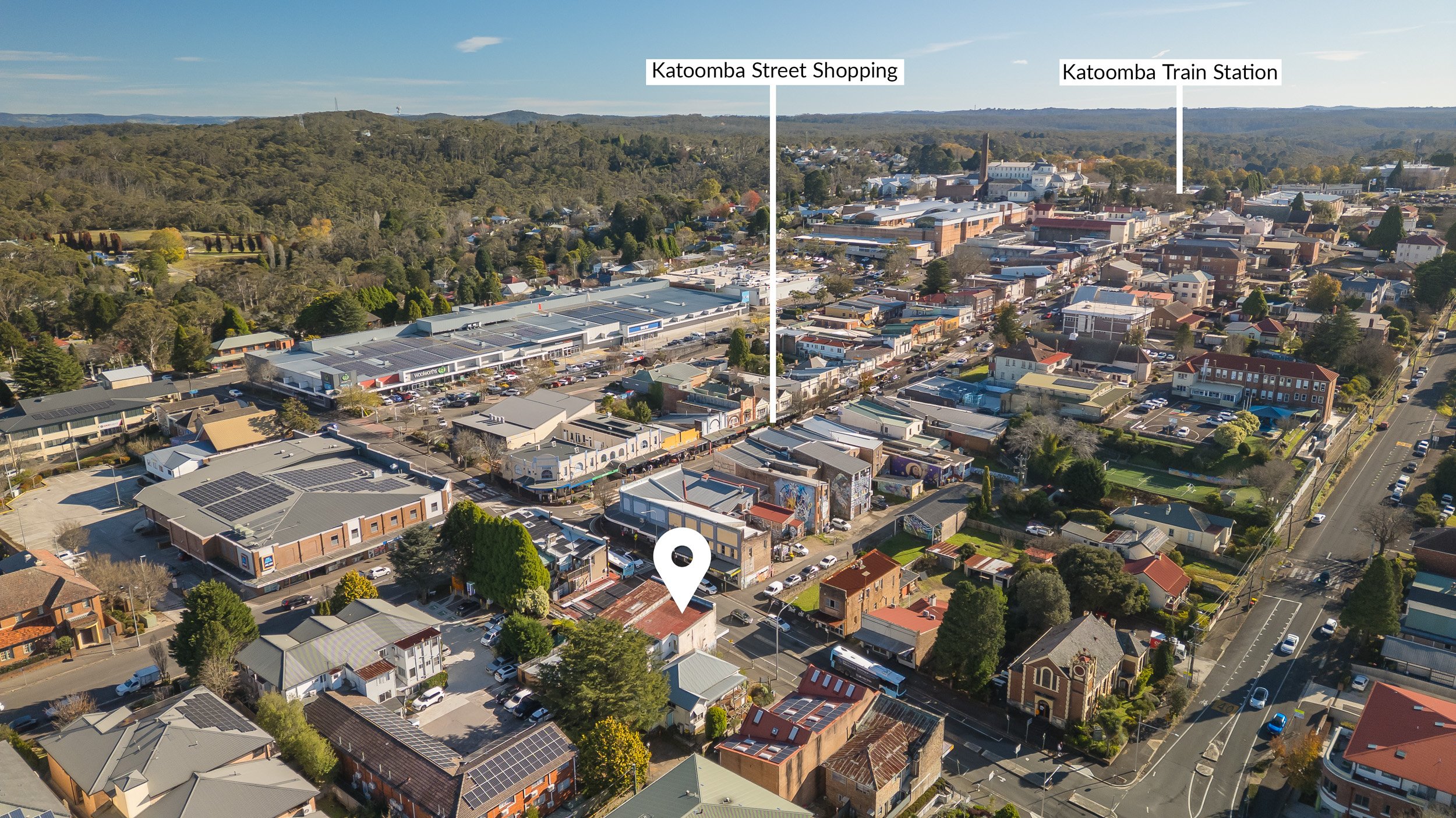
Site context with local amenities can help prospective businesses visualise the location of a commercial space with foot traffic, site access and proximity to the centre of town.
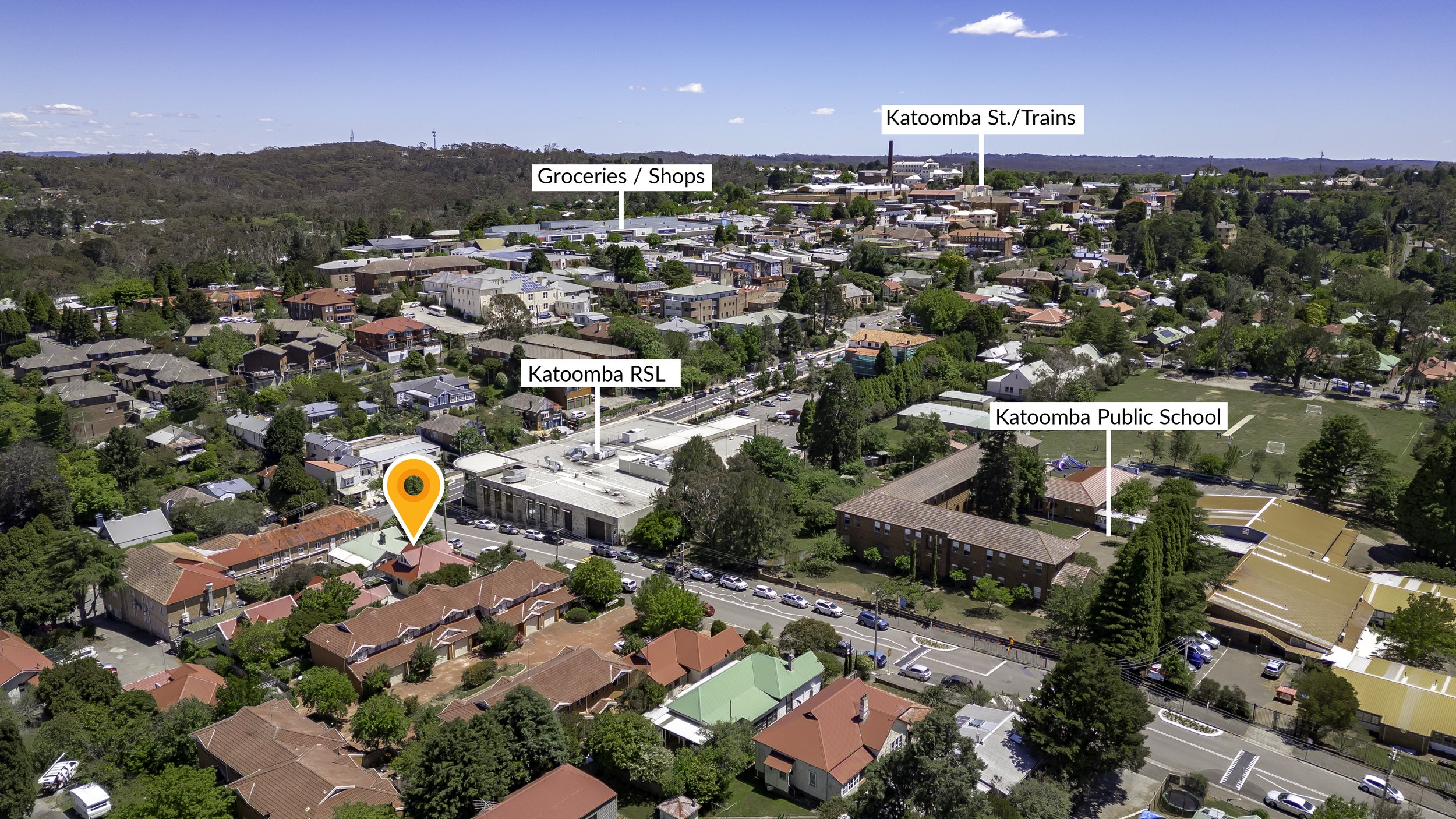
Site context with local amenities can help prospective residential clients consider proximity to schools, shopping, entertainment and transport.
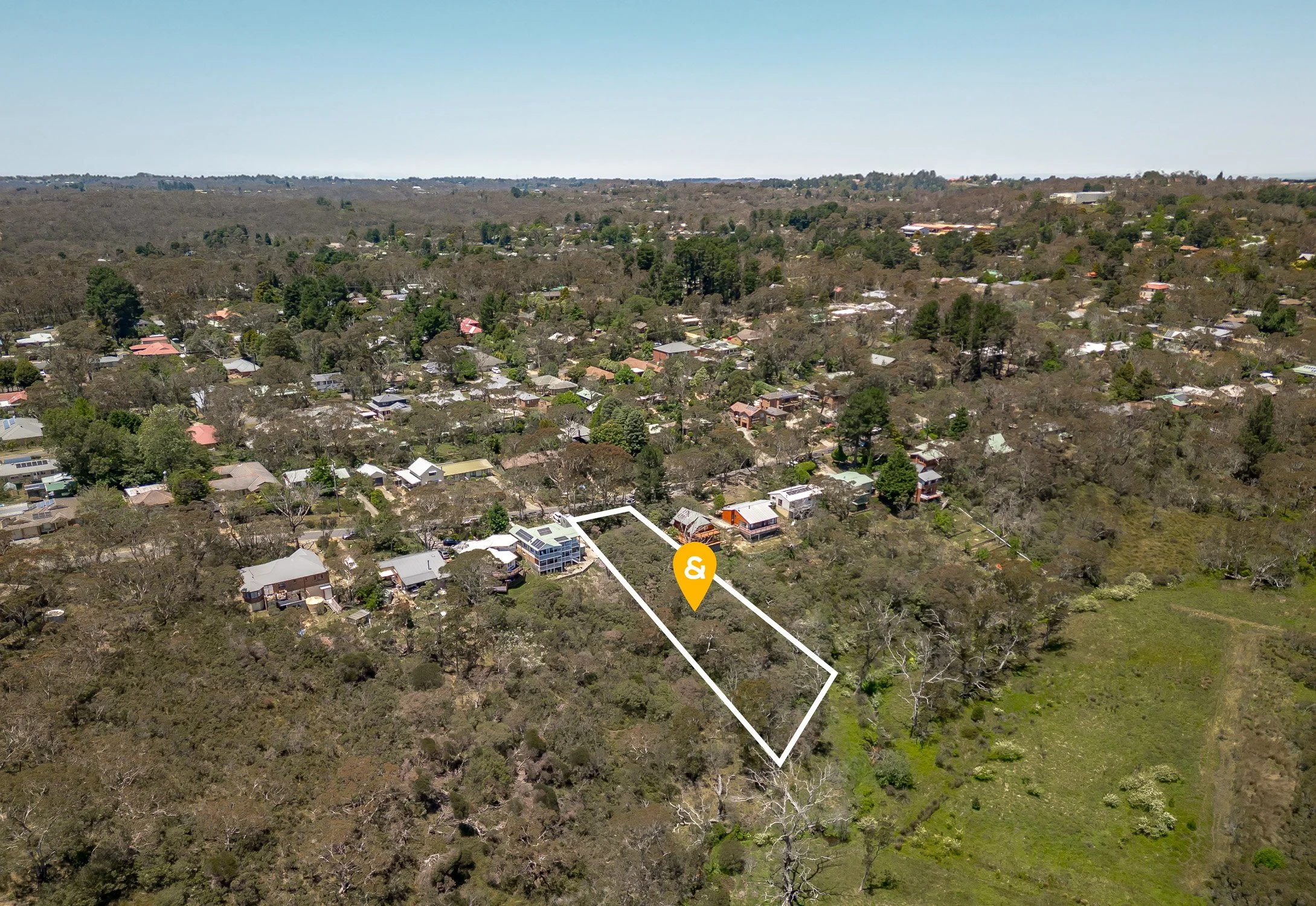
Aerial imagery of an empty lot can give potential buyers a sense of terrain and scale that’s hard to grasp when viewing the site on foot or with satellite maps like Google Maps.
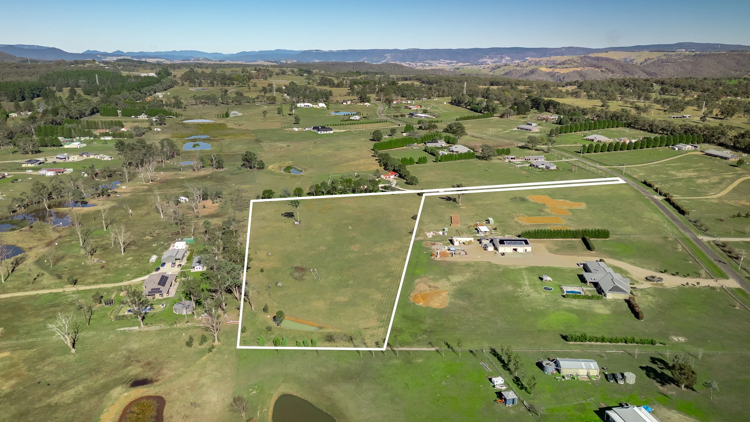
Aerial imagery in rural settings can show site context, access and other features on large parcels of land that are too difficult to see on the ground.
Frequently asked questions
Do you provide property boundary lines on drone photos? Yes. We can overlay approximate property boundary lines onto aerial shots based on supplied title, survey information or Council mapping systems, giving buyers a clear view of exactly what land is included in the sale.
Can you label nearby amenities on aerial images? Yes. We label nearby amenities — such as schools, shopping centres, cafes, parks, and train stations — directly on aerial images, so buyers can see a property's surrounding context at a glance without needing a separate map. If there’s a special feature you want us to highlight just let us know and we’ll be happy to add it!
Do you photograph vacant land or development blocks? Yes. We shoot vacant and unimproved blocks for sale or development, capturing shape, size, and surrounding context — useful for both private sale listings and development marketing material. With special requests we can overlay certain features such as Council zoning boundaries over a property (such as where a C4/C2 boundary exists on vacant land) to help potential buyers visualise potential areas of development available on a site.
Is drone photography available for commercial properties? Yes. We provide aerial photography for commercial properties, including site layout, access points, and surrounding infrastructure, suitable for sale and leasing campaigns.
Do you need to visit the property separately for drone shots? No — drone photography is typically captured during the same shoot as your standard real estate photography, so there's no need to schedule a separate appointment.
What areas do you cover for drone photography? We provide drone photography across the Blue Mountains, including Katoomba, Leura, Wentworth Falls, Lawson, Blackheath, Springwood, and Mount Victoria and more.
Are there any restrictions to shooting drone photography in the Blue Mountains? Yes. Alongside standard CASA guidelines which restrict drones from flying higher than 120m than their point of departure, drones are not permitted to be in the air when low-flying aircraft such as helicopters are operating nearby. This can limit when drones can shoot a property if helicopters are in use performing services for the National Parks, Police, Fire and Rescue services or when ferrying passengers over the mountains. Drones are also not able to be flown when visibility is low such as in inclement weather (rain/fog) or during reduction burns. In such cases we can often reschedule the drone shoot when we have clear, open skies. Being local to the Blue Mountains means that we’re able to keep our eye on the sky and shoot when the opportunities allow.